Return to: Home Page Canoeing Pages Routes and Photos Cedarstrip Project
Lake of Two Rivers to Whitney and the Hitchhiker Shuttle, Algonquin Provincial Park (September 7-11, 2000)
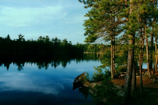
A quiet little bay on Galiaery Lake (click the photo for a detailed route description in CCR).
THURSDAY, September 7, 2000
This trip was a last minute thing. The CRCA Canoeing course I wanted to take was cancelled. I had already booked the time off work so I figured I may as well go paddling. I chose this route for the minimal portaging required.
I drove up Hwy #400/11 from Toronto and entered Algonquin Park from the West Gate, where I got my permit. From there I drove east on Hwy #60 to the Lake of Two Rivers, East Beach Picnic Area. I was originally going to put in on the West side of the Lake but I got lazy at the last minute. So I put my canoe on the sandy beach and stashed my kit in the bushes. Then I drove past the East Gate to Whitney.
Once in town I asked several people where the put-in/overnight parking for the Park was but most had no idea. I even followed a police car around a neighbourhood, flashing my lights to get his attention, but I don`t think he was paying attention. After having a tasty cheeseburger at a restaurant with a view of the Madawaska River, I went to grocery store and asked them where the Park access was. As it turned out, everyone knew where the public docks were but didn`t realise that was also the park access. So I crossed over Hwy 60, and took the first right south of the bridge over the Madawaska. Almost immediately you make another right turn on Post Road and follow this around until you come to the public dock on the right. I parked my car in the parking lot, made sure my permit was visible on the dash, and walked back into town. My plan was to hitchhike back to my canoe at Lake of Two Rivers but with the OPP station within site I didn`t think I would get a lift in town. So I walked about two kilometres to the Opeongo Outfitters store and about 45 minutes after setting out from Whitney I got a ride from a university student returning home for the weekend. He dropped me off where my canoe was and I was loaded up and in the water in a few minutes.
The East Beach is right at the river leading to Whitefish Lake. The Madawaska in its upper reaches is a narrow meandering river with a light current. About halfway down there is a very smooth 110 metre portage around a man-made dam. I arrived at my Whitefish Lake campsite 2 hours later. The first site on the east shore was taken. The original island site was closed for rehabilitation. It looked to be suffering some serious erosion problems. It was an ideal spot and I guess over the years its popularity began to take its toll. So I paddled the long way around the island looking for the new site. It was also occupied and I became concerned because there were only three sites marked on my map! I paddled to the west shore and found the last site unoccupied. Of the three sites this was the least desirable. Just a few metres behind the site is the old railway/bicycle trail. In two hours several groups of cyclists went by. They pass by unseen unless you go over to look, but you can hear them. Since the bike trail was an old railway line, it is very smooth and flat so probably not a very demanding ride. It looks like it might be a fun way to spend an afternoon.
FRIDAY
I slept late. Just packing up and its 1 PM already! The good thing is that there appears to be a tailwind today I will get a chance to use my sail.
I set off at about 1:45 and I did make good time under sail. The first kilometre was done in 10 minutes. But wind directions changed near the end of Whitefish Lake and I took the sail down just before reaching the first of the cottages. There are some nice little cottages at the south end of Whitefish Lake - small and not too imposing. Still, it did take away from the wilderness experience.
I paddled under the railway bridge and found myself once again in the meandering river. There were more nice cottages on the shore of the narrow river. All simple places - like how a cottage should be. Then you come to a campground around the bend. The parking lot was full of cars and the beach full of
people getting their canoes and sea kayaks ready to go out. As I paddled into
 Rock Lake
where I was going to camp and I saw many more craft on the water and another busy beach. Once out on Rock Lake I had a strong though intermittent tailwind so I set up the sail again. I had to sail at a slight angle a few degrees off my destination but most of Rock Lake was covered under sail. Because of the crowds I decided to press on for Galeairy Lake. I made it down the connecting river in no time thanks to the sail. The portage to Galeairy Lake is a short 100 metres around a man-made dam. Except for the first rocky 15 metres, this portage was also very flat and smooth.
Rock Lake
where I was going to camp and I saw many more craft on the water and another busy beach. Once out on Rock Lake I had a strong though intermittent tailwind so I set up the sail again. I had to sail at a slight angle a few degrees off my destination but most of Rock Lake was covered under sail. Because of the crowds I decided to press on for Galeairy Lake. I made it down the connecting river in no time thanks to the sail. The portage to Galeairy Lake is a short 100 metres around a man-made dam. Except for the first rocky 15 metres, this portage was also very flat and smooth.
Once in Galeairy Lake I paddled down the south finger to a little bay with only one campsite. I visited this spot with a friend about 20 years ago and it looked much the same now as it did then. The seclusion of this quiet little spot confirmed my decision not to stay on Rock Lake. Moreover, this last-minute decision allowed me a leisure day where I would not have to break camp, travel, and set up again.
From my Whitefish Lake campsite to the portage to Galeairy Lake took 2.5 hours. There was another half-hour leisurely paddle to the campsite in the bay.
SATURDAY
I woke up to a beautiful sunny day without a cloud in the bright blue sky. I went for an afternoon paddle to explore the little bay. I found the place where I put my friend ashore when he was suffering a migraine 20 years ago. Then I paddled south along the east shore where I spotted an interesting little piece of driftwood, which I returned to retrieve later. Along the east shore I discovered a set of stone steps at the shoreline. I almost didn`t notice them because they are so old and collapsing that they look almost a natural feature of the landscape. I got out to explore. The underbrush was very dense with closely packed small pine trees. The only way through was to plow through them while covering my face. Fifty metres up from the shore I found the ruins of an old house. Mostly all that was left was the fireplace area, which was actually two quite large sections. It must have once been a sizeable log home. I assume log because I found no collapsed stone walls. The logs must have decayed years ago, or been removed. After crashing back through the underbrush to the canoe, I paddled to the portage at the southernmost point of the bay and went for a short walk.
I returned to camp with some firewood and lazed around for the rest of the afternoon. When I was paddling back to camp I saw two small oil slicks floating on the water near shore. Later, while I was relaxing in camp, a motorboat came into the bay to do some fishing and was the only visitor to the bay for the two days I was there. I guess the presence of motor boats explains the oil slicks.
SUNDAY
I woke up to an overcast sky. It wasn`t threatening rain, just white/grey clouds. The clouds eventually broke up but never completely disappeared. Still, I had plenty of sunshine. After breakfast I paddled down to the westernmost corner of the bay to visit the portage near where my friend and I discovered wolf remains 20 years ago. The creek by the portage looked more overgrown than I remember. At the other end of the portage there is a beaver dam and maybe that explains the water level. I looked around for another ruin indicated on my map but I could not find it.
I returned to camp to pack up and have lunch. At 12:30 I set out for the final leg to the car. At first the wind was light, but by the time I was heading south-east on Galeairy Lake I was fighting a strong headwind. In the meantime, a group of five single person rowboats shot past me. The wind was especially strong just before rounding the corner to head east again. Once around the corner the wind was less of a problem. But where the lake opened up again I had a strong crosswind which is sometimes more difficult than a headwind! By the time I reached the take-out where my car was parked it had been three hours since leaving my campsite.
All in all it was a good trip. I especially appreciated the leisure day to sit around and do nothing - especially in that quiet little bay. It really made up for the crowds I saw the previous days. However, aside from the little bay, the cottages, crowds, bicycle trail, and motorboats all took away from the wilderness experience. Even so, it is an easy trip and Rock Lake looks beautiful with the cliffs on the east shore. This trip can be done easily in two days if you set out earlier and plan to camp on Rock Lake. There is also a hiking trail to the top of the cliffs on Rock Lake which would make a nice diversion if you stayed an extra day.